|
|
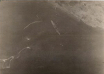
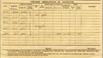
This is the top half of the the first page of Joe Townshend's navigation log from the sortie in which his aircraft discovered the Tirpitz off Tromso on 18 October 1941
Many thanks to Michael Townshend for sending us this picture. His father, Joe Townshend, was the navigator on this aircraft.
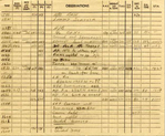
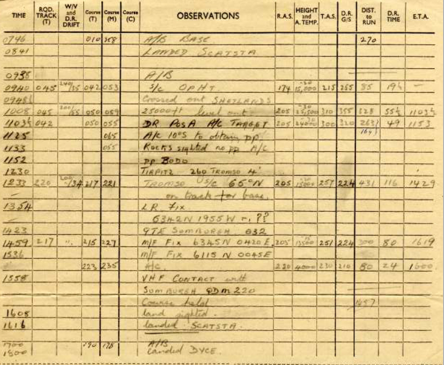
This part of the log records their progress during the day-long mission.
| 0746 | Airborne Base (Dyce) |
| 0841 | Landed Scatsta |
| 0937 | Airborne |
| 0940 | S/C OPHT (set course for OPHT) |
| 0948 | Crossed out Shetlands |
| 1008 | 25,000ft level out |
| 1103 | Dr Pos A A/C Target |
| 1125 | A/C 10 degree 5 to optain pp |
| 1133 | Rocks sighted no pp A/C |
| 1152 | pp Bodo |
| 1230 | Tirpitz 260 Tromso 4' |
| 1233 | Tromso US/C 66 degree N on track for base |
| 1354 | LR fix 6342N 1955W, ?? |
| 1423 | QTE Sumburgh 032 |
| 1459 | M/F Fix 6345N 0420E |
| 1536 | M/F Fix 6115N 0045E A/C |
| 1558 | VHF Contact with Sumburgh QDM 220 course held |
| 1608 | land sighted |
| 1616 | landed Scatsta |
| 1700 | airborne |
| 1800 | landed Dyce |
Their overall route thus took them from their base (the squadron was based at Leuchers near St. Andrews, but this flight started at Dyce, further to the north near Aberdeen), north to Scatsta on the mainland of the Shetland Islands, north/ north-east across the North Sea to Bodo on the Norwegian coast, then nearly 200 miles north up the Norwegian coast to Tromso, where the Tirpitz was found.
OPHT would appear to be a navigation point in the North Sea around 125 miles to the N/NE of Sumburgh on the Shetlands.
The long range location fix at 1354 appears to put them just off the south coast of Iceland, thus the question marks. The radio fix taken from Sumburgh was clearly more reassuring, putting them to the N/NE of the Shetlands.
The 1459 location then placed them on their correct route S/SW across the North Sea, west of Norway and north/ north-east of the Shetlands and the next fix put then just to the north-east of the Shetlands.