|
|
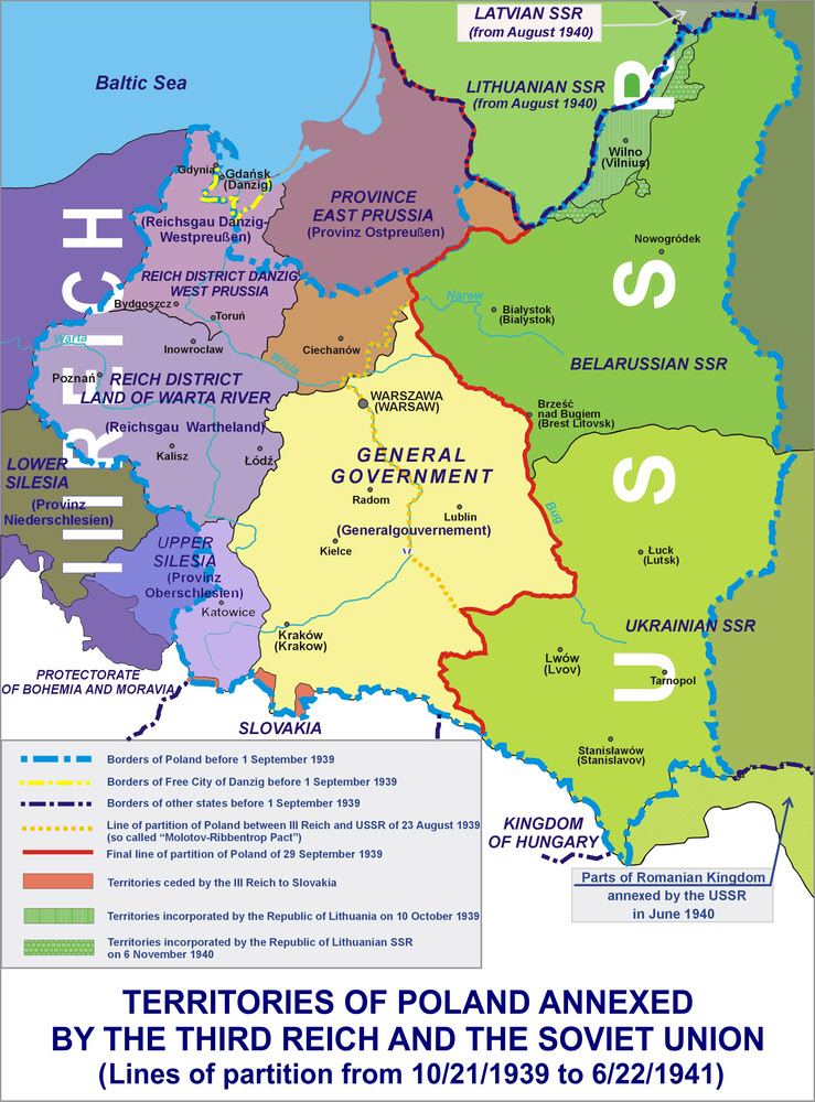
This map shows the partition of Poland after the German and Soviet invasions of 1939. In the east large areas were simply incorporated into the nearby Soviet Republics of Ukraine and Belarussia. In the German zone large parts of western Poland and areas around East Prussia were directly absorbed into Germany, partly by expanding existing provinces but mainly by creating two new Reichgau. In the centre a small area that the Germans recognised as occupied Polish territory and which became the General Government. After the German invasion of the Soviet Union the General Goverment was expanded east.
Lonio17 via Wikimedia Commons