Maps of the Battles of the Wars of the Roses
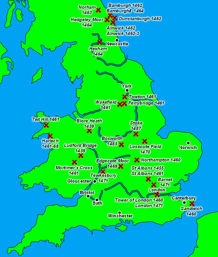
This clickable map shows the battles of the Wars of the Roses, from the first clash at St. Albansin in 1455 to the final battles of Bosworth in 1485 and Stoke in 1487. As this map shows the war directly affected large parts of England and Wales, but with clusters in the Midlands and the North East.
How to cite this article:
Rickard, J (2 September 2016), Maps of the Battles of the Wars of the Roses , http://www.historyofwar.org/Maps/maps_battles_wars_roses.html